What is a watershed?
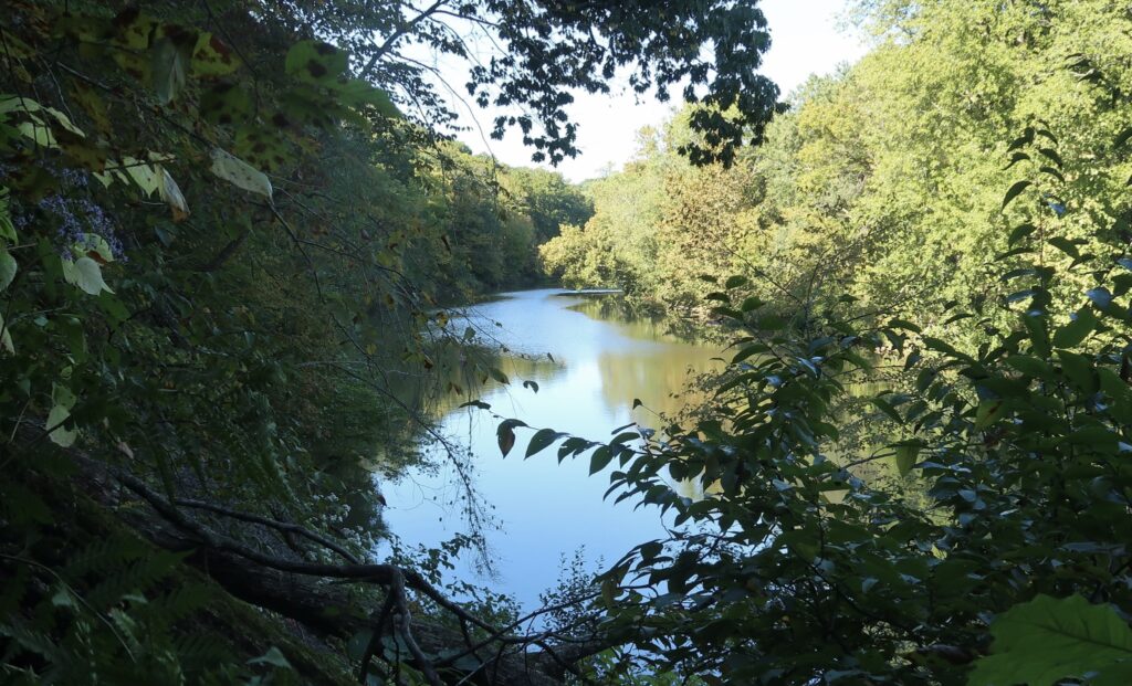
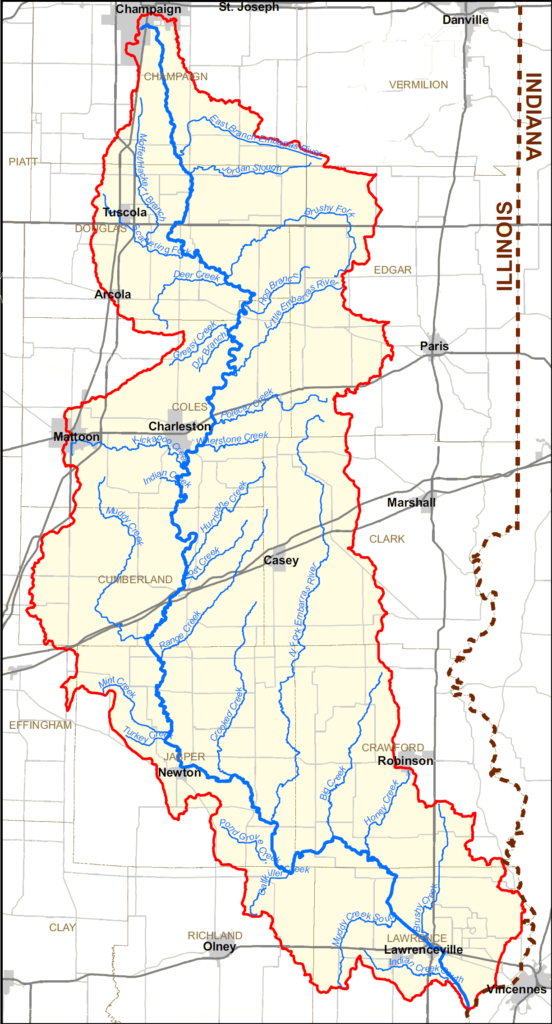
A watershed is an area of land where all water drains or “sheds” water into a specific waterbody such as a stream, river, lake, or ocean. The word “watershed” is sometimes used interchangeably with drainage basin or catchment. Every body of water, no matter how big or how small, has a watershed which consists of surface water and all the underlying groundwater. Larger watersheds contain many smaller watersheds. The Embarras River Watershed covers approximately 1.5 million acres and encompasses portions of 12 counties in Illinois: Champaign, Clark, Coles, Crawford, Cumberland, Douglas, Edgar, Effingham, Jasper, Lawrence, Richland, and Vermilion Counties. Some of the major tributaries include the North Fork Embarras River, Muddy Creek, Brushy Fork, Range Creek, and Crooked Creek.
The Embarras River watershed was identified in the Illinois Nutrient Loss Reduction Strategy (NLRS) as a priority area for reducing phosphorus losses. The NLRS helps guide efforts to improve water quality in all sectors and capacities within the state. One of the most impactful ways to address water quality and nutrient loss within watersheds is to develop and implement a watershed plan.
What is a watershed plan?
A watershed plan includes a comprehensive summary of the overall condition of a watershed and the protected waters that may be impacted by sources of pollutants, as well as provides a framework for effectively and efficiently restoring water quality in impaired waters. Further, watershed plans give direction to strategic implementation of conservation practices in order to meet water quality goals. Without a watershed plan in place, stakeholders have a decreased chance of receiving funding from certain state and federal programs for implementing conservation practices. All implementation of conservation practices is voluntary. Involving local stakeholders in the planning process is critical to the success of the watershed plan.
Applying for a Section 319 Grant to Update The Plan
The previous Embarras River Watershed Management Plan, written in 2011, had a lifespan of 10 years. In fall of 2018, several stakeholders began informally meeting to discuss the upcoming “expiration” of the plan. It was decided that an update was needed, and stakeholders across the watershed proved that they are committed to protecting the Embarras River by fundraising over 40% of the cost of the update, a requirement set forth by the Illinois EPA.
In July of 2019 the Coles County SWCD, with support and assistance from University of Illinois Extension, Illinois Farm Bureau, the Association of Illinois Soil and Water Conservation Districts, and several other SWCDs, county boards, municipalities, private landowners, and businesses, applied for a Section 319 Grant through the Illinois EPA, with a goal to update the Embarras River Watershed Management Plan and enable a seamless transition between the 2011 plan and the new version.
Watershed Planning Meetings
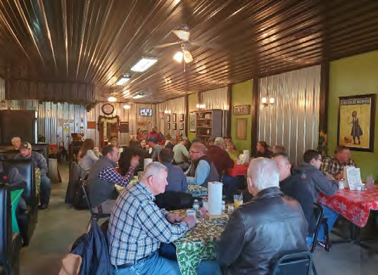
In January 2020 while waiting to hear from Illinois EPA on the status of the grant application, stakeholders across the watershed gathered to share their feedback on what the updated Embarras River Watershed Management Plan should include. With the help of a Nutrient Stewardship Grant from the Illinois Farm Bureau, ten County Farm Bureaus and Soil and Water Conservation Districts, with University of Illinois Extension, hosted nine Watershed Planning Meetings across the watershed. These meetings, though targeted to farmers, attracted individuals from many backgrounds, including landowners, elected officials, conservation enthusiasts, and others.
A summary report from the January 2020 meetings is available to download here. This report provides background information on previous and current watershed update efforts, as well as identifying high level takeaways from each meeting within the watershed.
A summary webinar to discuss the outcome of the meetings was held via Zoom in April of 2020. A recording of that webinar is available here. The feedback received from the meetings was incorporated in the updated Embarras River Watershed Management Plan.
Section 319 Funds Awarded to Update the Embarras River Watershed Management Plan
In January of 2021, the Coles County SWCD, on behalf of the stakeholders in the Embarras River Watershed, was awarded a Section 319 grant from Illinois EPA to update the watershed plan. Illinois EPA provided $106,614 over a two-year period, while stakeholders in the watershed provided $71,075 in match funds. The Coles County SWCD contracted with Northwater Consulting to conduct the plan update with assistance from local SWCDs, Extension, and Illinois Farm Bureau. The entire Embarras River Watershed Plan received a general update. Two “HUC 12” subwatersheds, The Slough and Polecat Creek, received more detailed planning. These watersheds were selected based on a data-driven analysis, stakeholder input, and staff capacity.
HUC 12 Subwatershed Planning: Polecat Creek and The Slough
In 2021, Illinois Farm Bureau sponsored two “hybrid” Nutrient Stewardship Field Days in the Embarras River Watershed through their Nutrient Stewardship Grant program. This hybrid approach included hosting in-person field days following regional COVID restrictions, as well as producing video coverage of each field day program. These two events were targeted toward stakeholders in Polecat Creek and The Slough, the priority HUC 12 subwatersheds chosen for detailed planning with the 319 Grant.
In March, IFB worked alongside partners from Richland and Lawrence County Farm Bureaus, University of Illinois Extension, Northwater Consulting, Lawrence and Richland County Soil and Water Conservation Districts, and Illinois Natural Resource Conservation Service to share progress on updating the Embarras River Watershed Management Plan. Topics covered also included information about the Nutrient Loss Reduction Strategy and improving soil health. Four farmers from Richland and Lawrence counties also participated in a panel discussion, sharing their experiences with cover crops. More info about this field day can be found here.
In July, Coles County Farm Bureau partnered with Coles County SWCD, University of Illinois Extension, Northwater Consulting, and Donahue & Associates, Inc. to host a Nutrient Stewardship Field Day near Charleston, Illinois. Topics covered included a focus on supporting education and outreach in the ERW, discussing the history of the watershed, IEPA 319 Grant and Watershed Management Plan updates, and local urban water use. The program concluded with a panel of farmers who shared their experiences with various conservation practices in the watershed. More info about this field day can be found here.
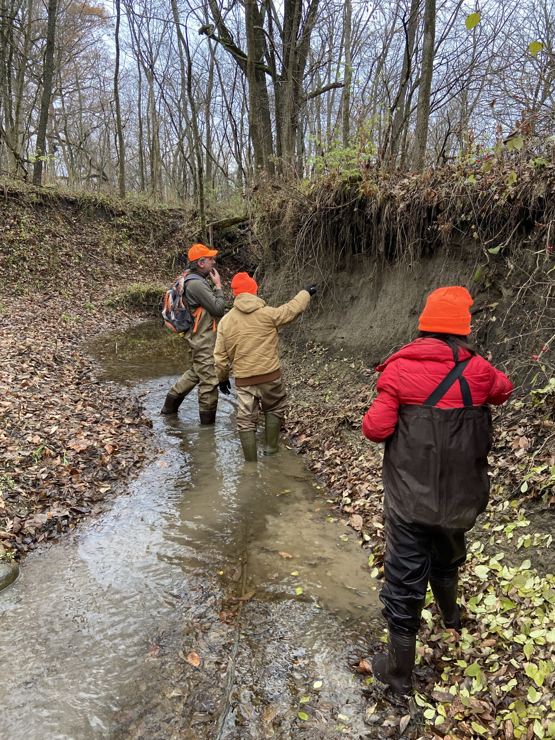
In addition to “windshield surveys” conducted in the entire Polecat Creek and The Slough watershed, several sections of the streams were waded by Northwater Consulting and partners from Coles County SWCD, University of Illinois Extension, and researchers from the University of Illinois for additional data collection. Extensive computer modeling was also conducted and analyzed for the plan updates.
Updated Watershed Management Plans Approved
In December 2022, the updated Embarras River Watershed Management Plan was approved by the Illinois EPA, along with watershed plans for Polecat Creek and The Slough. PDF versions of the plans can be downloaded at the following links.
Embarras River Watershed Management Plan & Appendix
Note: This is a large document and has been split into two files for ease of downloading.
Looking Ahead To The Next 10-Years
These plans give focus and direction in the coming 10 years to address multiple resource concerns in the watershed, with particular emphasis placed on water quality due to the Embarras River Watershed’s listing as a phosphorus priority watershed in the Illinois NLRS. Stakeholders in the watershed, such as municipalities and Soil and Water Conservation Districts, can utilize the watershed plans to apply for Section 319 Nonpoint Source Pollution Grant funds through the Illinois EPA for implementation of recommended conservation practices to improve water quality and reduce nutrient losses into local water bodies. Having an approved watershed plan in place increases the chances of receiving funding from organizations like Illinois EPA, and others, for implementation of projects to reduce nonpoint source pollution in both rural and urban settings within the watershed.